Canberra has been a place of constant expansion and development ever since it was named as Australia’s Capital city back in 1913.
However, satellite imaging of our city has now revealed just how much we’ve changed over the past 18 years.
In that time, we’ve seen the build of the Gungahlin Drive Extension, the development of the Kingston Foreshore and the introduction of Light Rail.
So, take a look back at our town centres and major precincts as they looked in 2004 and now in 2022.
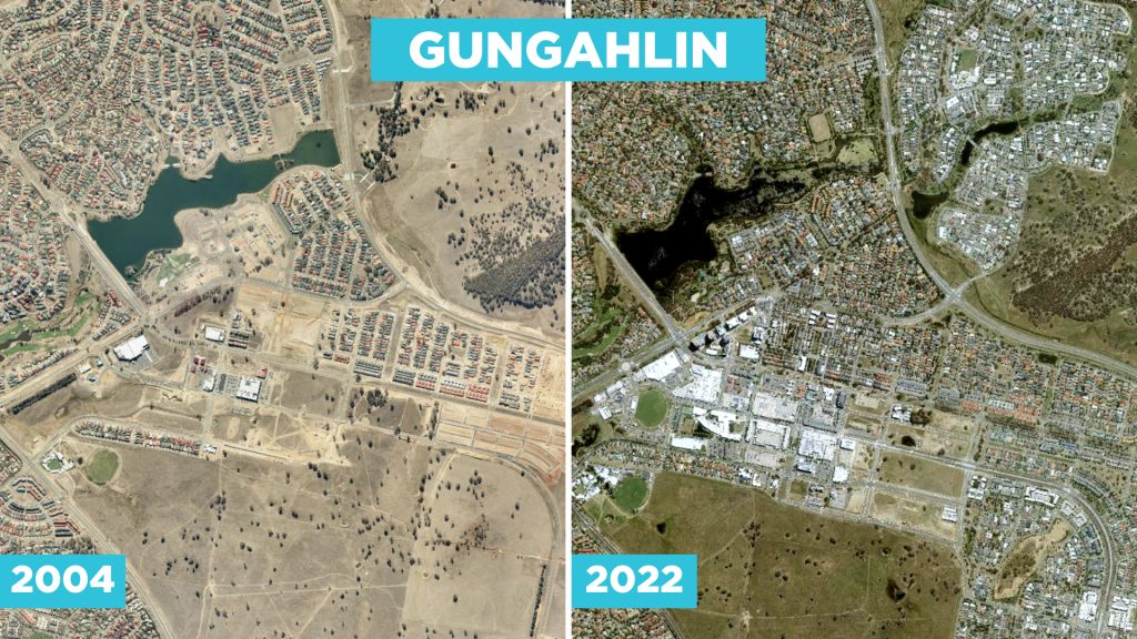
Gungahlin was simply just a town centre in the making back in 2004, there was no shopping centre, college or residential towers as is the case today.
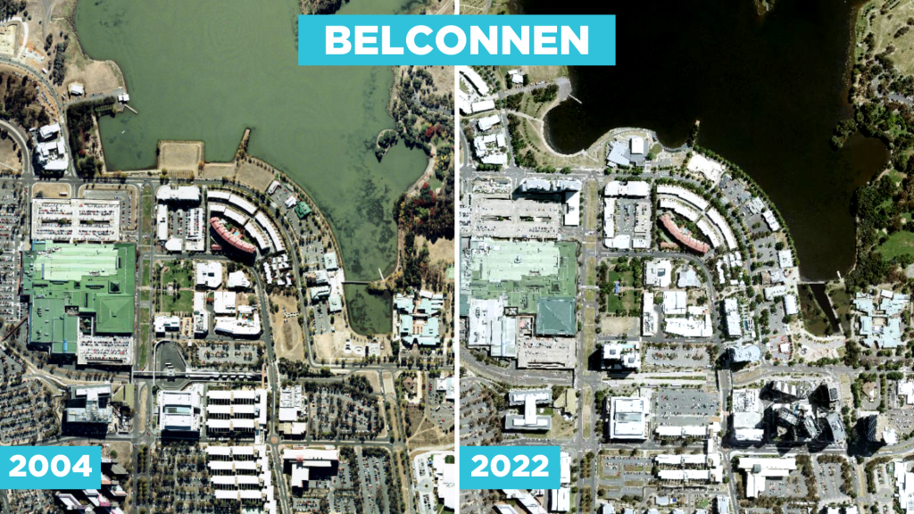
As one of Canberra’s oldest town centres, Belconnen has been forced to grow up rather than out but development has definitely continued along the lake’s edge in recent years.
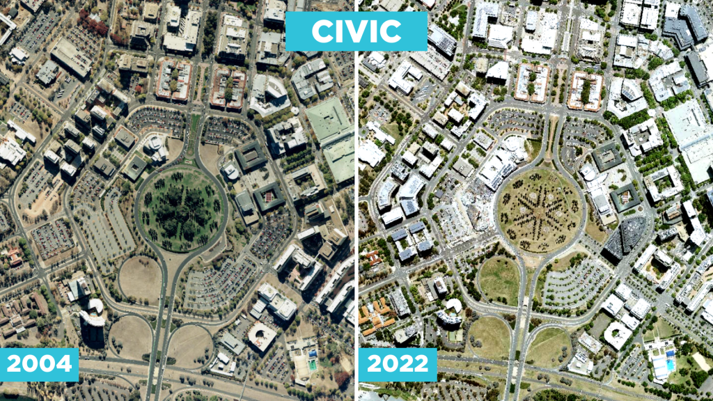
You’ll notice a lot less available parking in the city these days, thanks largely to redevelopment along London Cct at both ends near the ACT Courts and the Canberra Theatre.
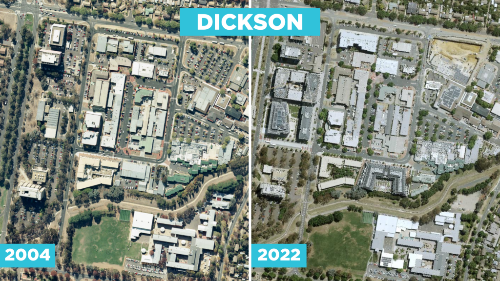
The DKSN redevelopment project continue to extend the Dickson precinct out towards the Northbourne Avenue Light Rail corridor, with growth now leading to the build of a second supermarket in the area.
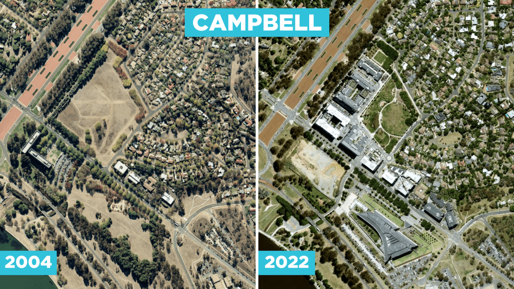
One, two, three, four – Campbell Five! The new residential precinct in the city’s inner north was nonexistent back in 2004. Today, You’ll also be able to spy the new ASIO HQ on the other side of Parkes Way.

The Northbourne Public Housing flats are no more as development along the stretch of road continues to increase and upsize thanks to Light Rail – may we also take a minute to pay our respects to the fallen trees who were cut down to make way for the new rail corridor.
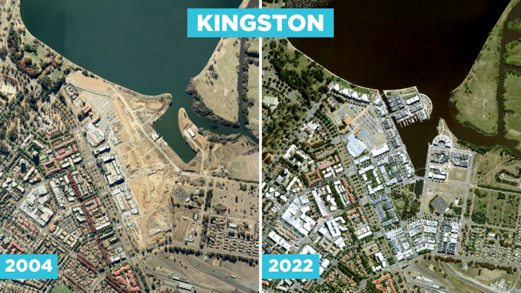
Kingston has certainly come a long way over the past 18 years – here you can see the completion of the Foreshore and as such the iconic resturant strip along the water. There are still grand plans in place for the area with the establishment of a new arts precinct expected to get underway in the coming years.
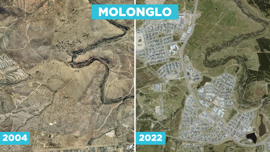
Canberra’s newest district was all but non-existent back in 2004.

As the oldest town centre outside of the city, Woden continues to grow upwards as new residential towers pop up at the northern end of the centre.
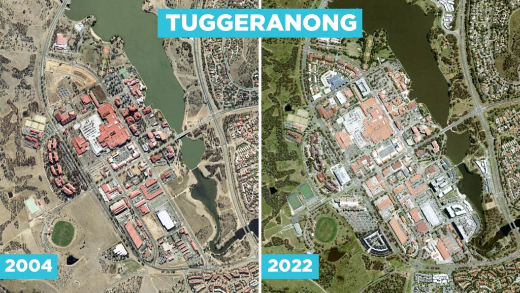
The old ‘Nappy Valley’ has certainly grown up over the past 18 years. The iconic red roofs continue to be a feature of the centre despite the significant urban infill in recent years – particularity along the Lake’s south side opposite Bunnings.
You can check out satellite imagery of any location in the ACT dating back to 2004 via visting the ACTmapi service online here and clicking on the ‘aerial imagery’ tab.
Listen to the latest news below:
You can stay up to date with all the latest news throughout the day, wherever you get your podcasts or by selecting ‘Mix Canberra News’ on your smart speaker.